Landforms are natural features on Earth’s surface. They include mountains, hills, valleys, plains, plateaus, islands, deserts, beaches, cliffs, caves, and many other shapes of land. These features make places look different and help people describe the world around them.
Learning landform names in English helps students, kids, teachers, travelers, and English learners build useful geography vocabulary. Some landforms rise high above the ground, while others stay flat, low, deep, rocky, sandy, or icy. With pictures, meanings, uses, and examples, landform vocabulary becomes easier to understand and remember.
In This Page
What Are Landforms?
Landforms are natural shapes or features of Earth’s surface. They may appear on land, near water, in deserts, along coasts, beside rivers, or in icy regions.
Nature creates landforms in many ways. Water cuts valleys and canyons, wind moves sand into dunes, ice carves valleys and fjords, and volcanoes build new land with lava and ash. Over time, these natural forces shape the land around us.
Quick Chart of Common Landforms
| Landform | Simple Meaning | Common Example |
|---|---|---|
| Mountain | Very high raised land | Himalayas |
| Hill | Smaller raised land | Rolling hill |
| Valley | Low land between hills or mountains | River valley |
| Plain | Wide flat land | Grass plain |
| Plateau | High flat land | Deccan Plateau |
| Desert | Dry land with little rain | Sahara Desert |
| Island | Land with water all around it | Ocean island |
| Peninsula | Land with water on three sides | Coastal peninsula |
| Canyon | Deep valley with steep sides | Grand Canyon |
| Cliff | High steep rock face | Sea cliff |
| Volcano | Landform with an opening for lava or ash | Mount Fuji |
| Glacier | Large slow-moving mass of ice | Mountain glacier |
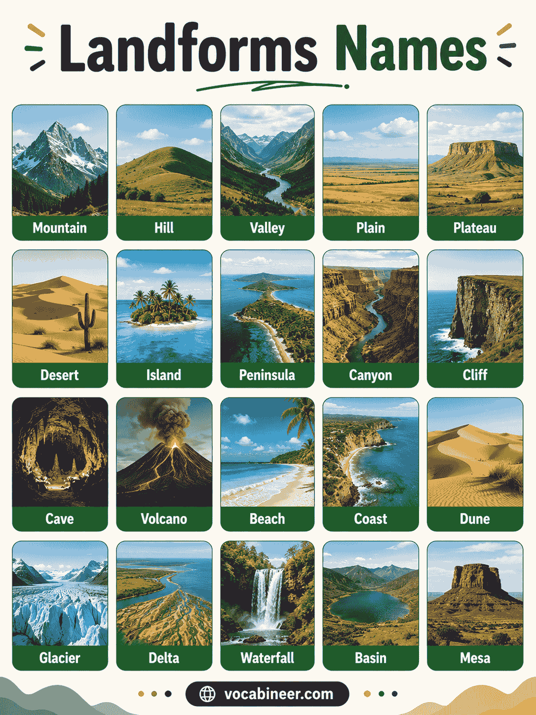
Common Landforms Names with Pictures
Pictures help learners recognize landforms by their shape, height, surface, slope, and location.
Mountain
A mountain is very high raised land, often with steep sides and a peak.
Hill
A hill is raised land that is usually lower and smaller than a mountain.
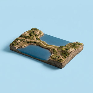
Valley
A valley is low land between hills or mountains. Rivers often flow through valleys.
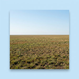
Plain
A plain is a large area of flat or gently rolling land. Farmers often use plains for crops.
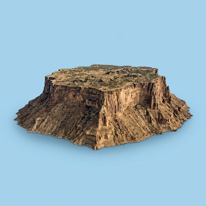
Plateau
A plateau is high land with a flat top. It looks like a raised plain.
Desert
A desert is dry land that receives very little rain. Some deserts are sandy, while others are rocky or cold.
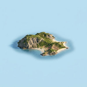
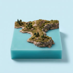
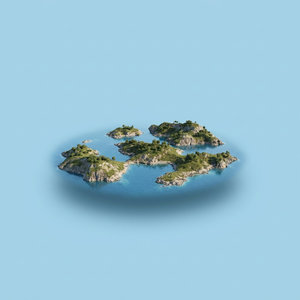
Island
An island is land surrounded by water on all sides.
Peninsula
A peninsula is land surrounded by water on three sides, but it stays connected to a larger land area.
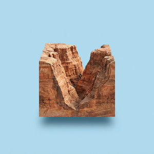
Canyon
A canyon is a deep valley with steep sides. Rivers often cut canyons through rock over long periods.
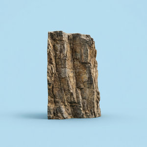
Cliff
A cliff is a high, steep rock face. Cliffs often appear near coasts, mountains, and river valleys.
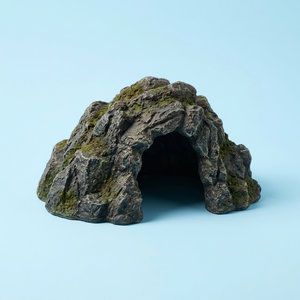
Cave
A cave is a natural opening or hollow space in rock or ground.
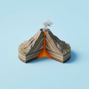
Volcano
A volcano is a mountain or hill with an opening where lava, ash, and gases may come out.
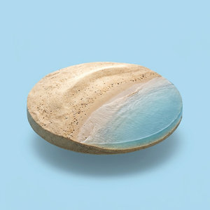
Beach
A beach is land beside an ocean, sea, lake, or river. It often has sand, pebbles, or shells.
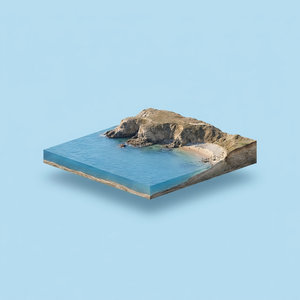
Coast
A coast is the area where land meets the sea or ocean.
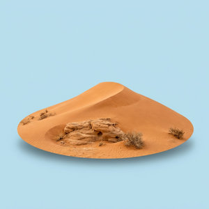
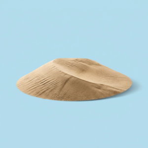
Dune
A dune is a hill of sand shaped by wind. Dunes commonly appear in deserts and near beaches.
Glacier
A glacier is a large mass of ice that moves slowly over land.
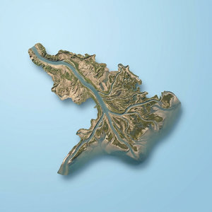
Delta
A delta is land that forms near the mouth of a river when the river drops sediment.
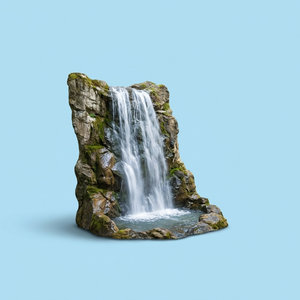
Waterfall
A waterfall is a place where water drops from a higher level to a lower level.
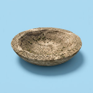
Basin
A basin is a low area of land where water may collect.
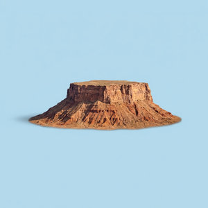
Mesa
A mesa is a flat-topped hill or mountain with steep sides.
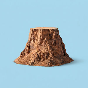
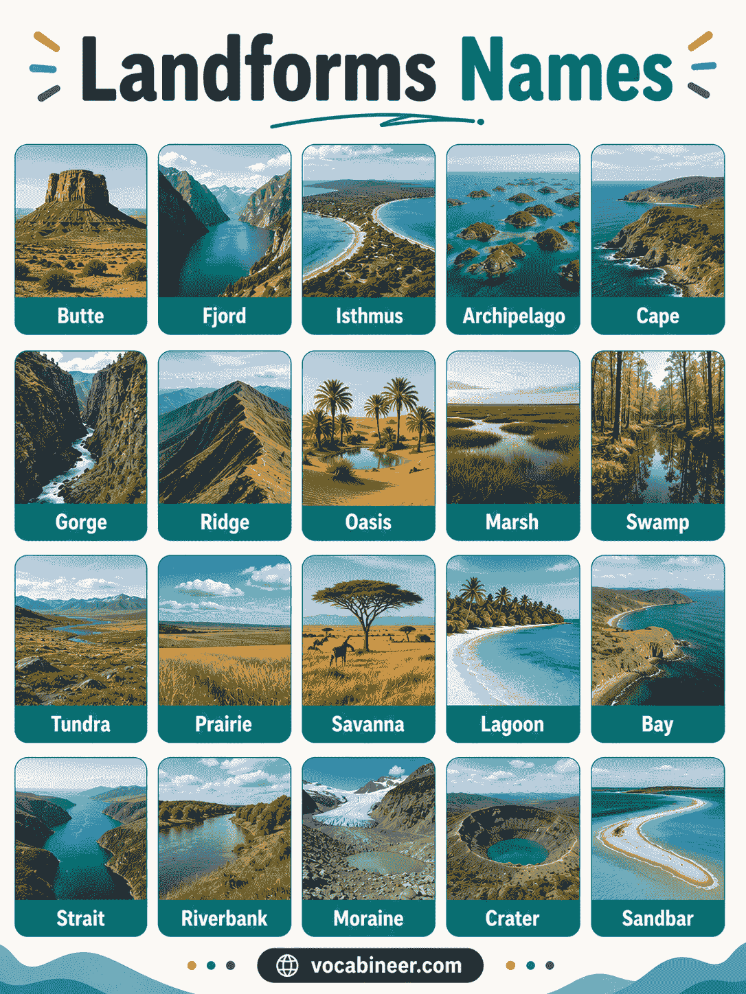
Butte
A butte is a smaller flat-topped hill with steep sides.
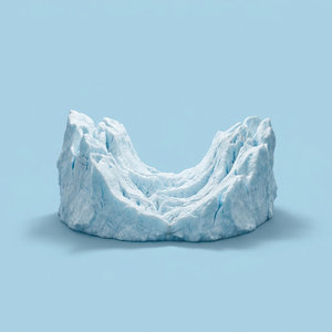
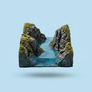
Fjord
A fjord is a long, narrow sea inlet with steep sides. Glaciers usually shape fjords.
Isthmus
An isthmus is a narrow strip of land that connects two larger land areas.
Archipelago
An archipelago is a group or chain of islands.
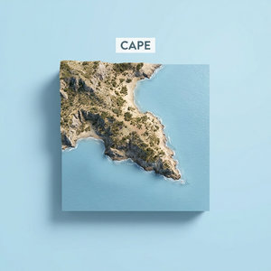
Cape
A cape is a piece of land that extends into water.
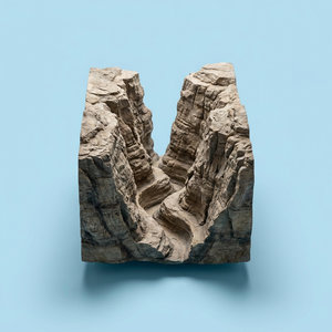
Gorge
A gorge is a deep, narrow valley with steep rocky sides.
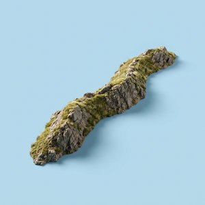
Ridge
A ridge is a long, narrow high area of land.
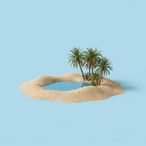
Oasis
An oasis is a green or fertile area in a desert where water is available.
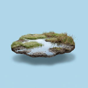
Marsh
A marsh is wet, low land with grasses and soft plants.
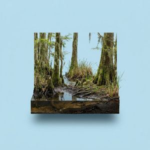
Swamp
A swamp is wet land with trees, shrubs, and standing water.
Major Landforms and Smaller Land Features
Some landforms cover very large areas, while others describe smaller parts of a landscape. This difference helps learners organize landform names more clearly.
| Category | Meaning | Examples |
|---|---|---|
| Major landforms | Large natural features of Earth’s surface | Mountains, plains, plateaus, deserts |
| Smaller land features | Smaller shapes within larger landscapes | Cliffs, caves, dunes, ridges |
| Coastal features | Landforms near seas or oceans | Beaches, capes, islands, peninsulas |
| River features | Landforms shaped by rivers | Deltas, valleys, canyons, waterfalls |
| Ice features | Landforms shaped by glaciers | Glaciers, fjords, ice valleys |
Landform Names with Simple Meanings
| Landform Name | Simple Meaning |
|---|---|
| Mountain | Very high raised land |
| Hill | Smaller raised land |
| Valley | Low land between higher areas |
| Plain | Wide flat land |
| Plateau | High flat land |
| Desert | Dry land with little rain |
| Island | Land surrounded by water |
| Peninsula | Land surrounded by water on three sides |
| Canyon | Deep valley with steep sides |
| Cliff | Steep rock face |
| Cave | Natural hollow space in rock or ground |
| Volcano | Landform with an opening for lava or ash |
| Beach | Sandy or pebbly land beside water |
| Coast | Area where land meets sea or ocean |
| Dune | Hill of sand shaped by wind |
| Glacier | Large moving mass of ice |
| Delta | Land formed where a river drops sediment |
| Waterfall | Water dropping from a high place |
| Basin | Low area where water may collect |
| Mesa | Flat-topped landform with steep sides |
| Butte | Smaller flat-topped hill with steep sides |
| Fjord | Narrow sea inlet shaped by glaciers |
| Isthmus | Narrow land connecting larger land areas |
| Archipelago | Group of islands |
| Cape | Land that extends into water |
| Gorge | Deep narrow valley with steep sides |
| Ridge | Long narrow raised land |
| Oasis | Green water area in a desert |
| Marsh | Wet grassy land |
| Swamp | Wet land with trees and water |
Landforms by Shape and Surface
Landforms look different because they have different shapes, heights, and surfaces. Some rise upward, while others stretch flat, dip low, or form sharp edges.
| Shape or Surface | Landforms | Visual Clue |
|---|---|---|
| High and raised | Mountain, hill, plateau, ridge | Land rises above nearby areas |
| Flat or open | Plain, plateau | Wide surface with little slope |
| Low or deep | Valley, basin, canyon, gorge | Land sits between higher areas |
| Steep or rocky | Cliff, canyon, gorge | Sharp sides or rock walls |
| Sandy | Desert, dune, beach | Sand covers much of the surface |
| Wet or coastal | Marsh, swamp, beach, coast | Water appears nearby |
| Icy | Glacier, fjord | Ice or glacial shape appears |
Landforms by Place and Environment
Landforms also change based on where they appear. For example, coastal areas have beaches and cliffs, while deserts often have dunes and oases.
Mountains, Hills, and Valleys
| Landform | Where It Appears | Simple Feature |
|---|---|---|
| Mountain | Mountain ranges and highlands | Very high raised land |
| Hill | Countryside, parks, and rural areas | Smaller raised land |
| Valley | Between mountains or hills | Low land |
| Ridge | Mountain or hill areas | Long narrow high land |
| Plateau | Highland regions | Flat land at a high level |
Coastal Landforms
| Landform | Where It Appears | Simple Feature |
|---|---|---|
| Beach | Beside seas, oceans, lakes, or rivers | Sandy or pebbly shore |
| Coast | Edge of land near sea or ocean | Land meets water |
| Cliff | Rocky coasts | Steep rock wall |
| Cape | Coastal areas | Point of land |
| Peninsula | Coastal regions | Land with water on three sides |
| Island | Sea, ocean, lake, or river | Water surrounds all sides |
River Landforms
| Landform | Where It Appears | Simple Feature |
|---|---|---|
| Valley | Along rivers or between hills | Low land |
| Delta | River mouth | Sediment-built land |
| Waterfall | Steep river section | Falling water |
| Canyon | River-cut rocky areas | Deep steep valley |
| Gorge | Narrow rocky valley | Steep sides |
| Basin | Low land area | Water may collect |
Desert Landforms
| Landform | Where It Appears | Simple Feature |
|---|---|---|
| Desert | Dry regions | Little rainfall |
| Dune | Sandy deserts and beaches | Sand hill |
| Oasis | Desert areas | Water and plants |
| Mesa | Dry rocky regions | Flat top and steep sides |
| Butte | Dry open land | Smaller flat-topped hill |
Ice and Glacial Landforms
| Landform | Where It Appears | Simple Feature |
|---|---|---|
| Glacier | Cold mountains and polar regions | Large moving ice |
| Fjord | Coasts shaped by glaciers | Narrow sea inlet |
| Ice valley | Mountain regions | Valley shaped by ice |
| Moraine | Glacier edges or ends | Rock and soil left by ice |
How Landforms Are Formed
Landforms form through natural processes that change Earth’s surface. These changes may happen slowly over thousands or millions of years. However, volcanoes and earthquakes can change land more quickly.
Water shapes many landforms through erosion and deposition. For example, rivers cut valleys and canyons, while they build deltas by dropping sediment near their mouths.
Wind also shapes landforms. It moves sand in deserts and near beaches, so dunes can grow, shift, or change shape over time.
Ice changes land in cold regions. Glaciers move slowly, but they can carve valleys, scrape rocks, and create fjords.
Volcanic activity builds land when lava and ash collect around an opening in Earth’s surface. Because of this process, volcanoes can become mountains or islands.
Tectonic activity also shapes landforms. It can lift, fold, or break Earth’s crust, and as a result, mountains, plateaus, valleys, and cliffs may develop.
Important Geography Words for Landforms
| Word | Meaning |
|---|---|
| Erosion | How wind, water, or ice wear away land |
| Weathering | How rocks break down into smaller pieces |
| Deposition | How sediment settles in a new place |
| Sediment | Small pieces of rock, sand, soil, or minerals |
| Elevation | Height above sea level |
| Slope | The slant or steepness of land |
| Terrain | The shape and surface of an area |
| Tectonic activity | Movement of Earth’s crust |
| Volcanic activity | Lava, ash, and gases coming from Earth |
| Glacier | A large slow-moving mass of ice |
| Coastline | The line where land meets sea or ocean |
| River mouth | The place where a river enters another body of water |
How to Identify Landforms
You can identify landforms by looking at shape, height, slope, surface, water, and location. Pictures help because many landforms have clear visual clues.
| Clue | Possible Landform | Example |
|---|---|---|
| Very high raised land | Mountain | Snowy mountain |
| Small raised land | Hill | Green hill |
| Low land between mountains | Valley | River valley |
| Wide flat land | Plain | Grass plain |
| High flat land | Plateau | Raised flat area |
| Dry sandy area | Desert or dune | Sand desert |
| Land surrounded by water | Island | Ocean island |
| Water on three sides | Peninsula | Coastal peninsula |
| Deep valley with steep sides | Canyon or gorge | Rocky canyon |
| Steep rock wall | Cliff | Sea cliff |
| Large moving ice | Glacier | Mountain glacier |
| Land at a river mouth | Delta | River delta |
Common Landforms in Daily Life
People see landforms in villages, cities, parks, farms, beaches, mountains, and travel destinations. Even simple places often include small land features.
| Landform | Where You May See It |
|---|---|
| Hill | Countryside, parks, roadsides |
| Valley | Between hills or mountains |
| Plain | Farms, grasslands, open fields |
| Beach | Near seas, lakes, or rivers |
| Cliff | Coasts, mountains, rocky areas |
| Cave | Hills, mountains, limestone areas |
| Riverbank | Beside rivers |
| Dune | Deserts and sandy beaches |
| Plateau | High flat regions |
| Waterfall | Mountain streams and rivers |
Landforms for Kids
Landforms become easier for kids when each name connects with a simple shape.
| Landform | Kid-Friendly Meaning |
|---|---|
| Mountain | Very tall land |
| Hill | Small mountain-like land |
| Valley | Low land between high places |
| Plain | Big flat land |
| Plateau | Flat land on top of high land |
| Island | Land with water all around it |
| Peninsula | Land with water on three sides |
| Desert | Very dry land |
| Beach | Sandy land near water |
| Volcano | Mountain that can release lava |
Kids can remember landforms by looking at their shapes. For example, a mountain goes up, a valley goes down, and an island has water all around it.
Example Sentences with Landform Names
- The mountain was covered with snow.
- A small hill stood behind the village.
- Farmers grew wheat on the wide plain.
- The river flowed through a green valley.
- The plateau looked flat at the top.
- Many animals live in the desert.
- We visited an island during our vacation.
- The peninsula stretched into the sea.
- The canyon had steep red rock walls.
- Waves crashed against the tall cliff.
- The cave was dark and cool inside.
- The volcano released ash into the sky.
- Children played on the sandy beach.
- Strong winds shaped the dune.
- The river formed a delta near the sea.
Common Landform Differences
Some landform names look similar, but they have different meanings. This table explains the most common differences.
| Comparison | First Term | Second Term | Main Difference |
|---|---|---|---|
| Mountain vs Hill | Mountain | Hill | A mountain is usually higher and steeper, while a hill is smaller and gentler. |
| Valley vs Canyon | Valley | Canyon | A valley is low land between higher areas, while a canyon is a deep, narrow valley with steep rocky sides. |
| Island vs Peninsula | Island | Peninsula | An island has water on all sides, while a peninsula has water on three sides and connects to larger land. |
| Canyon vs Gorge | Canyon | Gorge | Both are deep valleys, but a gorge is often narrower and very steep. |
| Mesa vs Butte | Mesa | Butte | A mesa is a larger flat-topped landform, while a butte is smaller and narrower. |
| Desert vs Dune | Desert | Dune | A desert is a dry region, while a dune is a hill of sand found in deserts or near beaches. |
| Landform vs Body of Water | Landform | Body of water | A landform is a natural shape of land, while a body of water is a water area such as a river, lake, sea, or ocean. |
| Landform vs Landscape | Landform | Landscape | A landform is one natural feature, while a landscape is the full view of an area with many features. |
Common Mistakes with Landform Names
| Mistake | Correct Information |
|---|---|
| A hill and a mountain are always the same | A mountain is usually higher and steeper than a hill |
| An island and a peninsula are the same | An island has water on all sides, while a peninsula has water on three sides |
| A valley and a canyon mean the same thing | A canyon is usually deeper and has steeper sides |
| A desert is always hot | Some deserts are cold |
| A beach only appears near the ocean | Beaches can also appear near lakes and rivers |
| A volcano is always active | Some volcanoes are active, dormant, or extinct |
| A landform and a body of water are the same | Landforms describe land shapes, while bodies of water describe water areas |
| A landscape means only one landform | A landscape often includes many landforms and natural features |
FAQs
Landforms are natural features or shapes on Earth’s surface. Mountains, valleys, plains, plateaus, islands, beaches, cliffs, and deserts are common examples. They help people describe different places and landscapes.
The main landforms include mountains, hills, valleys, plains, plateaus, deserts, islands, peninsulas, canyons, cliffs, and coastal features. Some geography lessons group major landforms as mountains, plains, plateaus, and hills. However, vocabulary lists often include many smaller land features too.
A landform is a natural shape of land, such as a mountain, valley, plain, or island. A body of water is a water area, such as a river, lake, sea, or ocean. Some landforms, like beaches and deltas, form near water.
Common landform names for kids include mountain, hill, valley, plain, island, beach, desert, volcano, cave, and waterfall. These names are easy to learn because their shapes are simple to recognize in pictures.
Landforms form through natural processes such as erosion, weathering, deposition, volcanic activity, tectonic movement, and glacial movement. Water, wind, ice, and heat can slowly change Earth’s surface. Over time, these forces create mountains, valleys, cliffs, deltas, dunes, and many other landforms.
Summary
Landforms are natural features that shape Earth’s surface. They include raised areas like mountains and hills, flat areas like plains and plateaus, low areas like valleys and basins, and coastal features like beaches, cliffs, islands, and peninsulas.
Learning landform names in English helps students and kids understand geography vocabulary more clearly. Pictures, meanings, examples, comparison tables, and simple sentences make these names easier to remember and use.
Read More
- Types of Minerals
- Different Types of Soil
- Crockery Items Names
- Dining Room Furniture
- Types of Drinking Glasses